
Construction Staking for Smooth Infill Construction
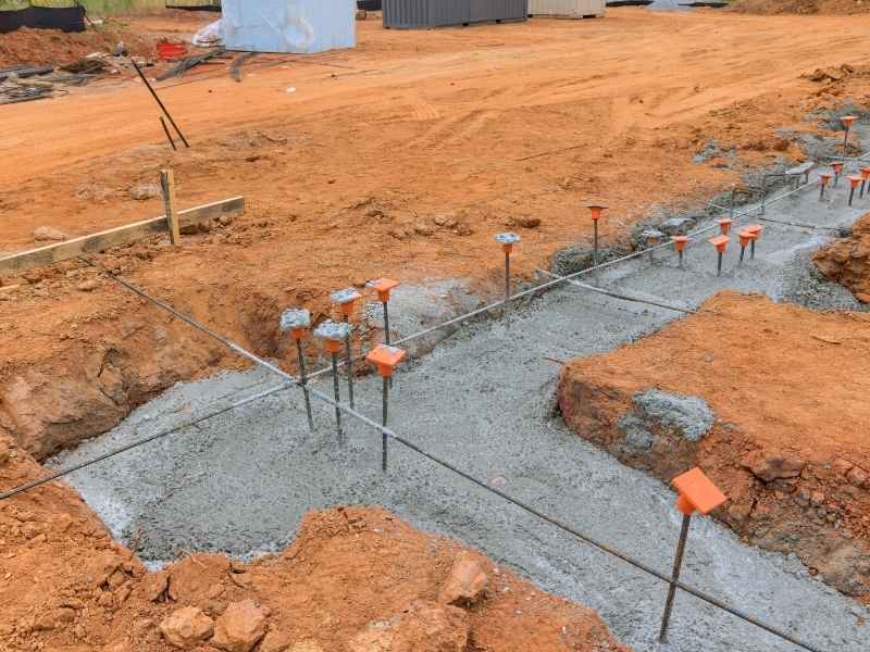
Infill lots don’t forgive mistakes. You’re building between existing homes, fences, driveways, and utility lines, often with only a few feet to spare on each side. A foundation placed half a foot off can mean a setback violation, a redesign, or a tense conversation with the neighbor.
Construction staking is the process of marking a design on the ground so crews know exactly where to build. A surveyor uses the approved plans to set stakes, nails, or paint marks that show building corners, offsets, grades, and utility locations. On an open field, small errors can sometimes be absorbed. On an infill site, there’s no room to absorb them.
The takeaway is simple. Bring your surveyor in before excavation starts, and keep them involved through foundation work. The sections below explain what staking covers on a tight site and how it keeps your project on plan.
Why Infill Sites Require More Precise Construction Staking
Infill sites need tighter staking because the margin for error is much smaller. The new building has to fit inside setback lines while working around structures that are already there. Neighbors, existing utilities, and street improvements all limit where the work can go. A layout that’s slightly off can create problems that are hard and expensive to undo.
Older neighborhoods add another challenge. Property corners may be missing, buried, or disturbed by years of fence work and landscaping. Old records may not match what’s on the ground. Before staking begins, the surveyor needs to confirm the boundary so the building is placed from the correct lines.
That boundary work is the foundation for everything that follows. Building corners, utility runs, and grade marks are all measured from control points tied to the property lines. If the starting point is wrong, every stake after it will be wrong too.
Working Within Tight Property Lines and Existing Improvements
On a tight lot, staking shows crews exactly how close they can build to each line. The surveyor sets the building corners based on the site plan and checks their distance to the boundary. Those measurements help confirm the structure will meet the setbacks shown on the approved plans. Setback rules vary by municipality and zoning district, so the plan set is your guide.
Existing improvements often complicate the layout. A neighbor’s fence may not sit on the true line. An old retaining wall might lean over the boundary. Tree roots, sheds, and paved areas can also get in the way of excavation.
Because corner stakes are often lost during digging, surveyors usually set offset stakes as well. An offset stake is placed a set distance away from the actual corner, outside the work zone. Crews can then measure back from it to find the corner again. On a narrow lot, finding safe spots for offsets takes some planning, so talk about it with your surveyor before the crew arrives.
Coordinating Building Layout With Utilities and Access
Utility and access staking helps new work connect to existing systems without costly surprises. Infill projects usually tie into water, sewer, gas, and electric lines that are already in service. The plans show where those connections should happen, and staking shows the crew where to dig. That coordination matters even more on a small site where lines run close together.
Before any digging, contractors should request a utility locate through the state one-call system. That service marks many buried public utility lines. It may not mark private lines, such as an old sewer lateral or a buried irrigation line. The surveyor’s staking and the locate marks work together, but neither replaces careful field checks.
Access also needs attention. Staking can mark the driveway location, curb cuts, and the edge of the right-of-way. The right-of-way is the strip of land along the street that’s set aside for public use. Work in that area may require a separate permit, depending on the city or county.
Checking Elevations Before Foundations and Site Work Begin
Elevation staking tells crews how high or low to build. The surveyor sets grade stakes that show how much soil to cut or fill at key points. These marks are based on a benchmark, which is a fixed point with a known elevation. Every height on the site is measured from that same reference.
On infill lots, elevations have to work with the properties around them. The new building’s finished floor must sit at the height shown on the plans. The yard has to drain away from the foundation without sending water onto the neighbor’s lot. Driveways need to meet the street at a workable slope.
Checking these grades before foundations go in can prevent serious problems. A foundation set too low can collect water. One set too high can throw off steps, driveways, and drainage. Many builders also ask the surveyor to check forms before concrete is placed, since fixing a mistake at that stage is far cheaper than fixing it after the pour.
Using Staking to Keep Infill Construction on Plan
Staking works best as an ongoing service, not a single visit. Early stakes guide excavation, while later stakes guide foundations, utilities, flatwork, and final grading. Each phase builds on the last. Keeping the same surveyor involved helps make sure every phase uses the same control points.
Here’s what builders and owners should confirm before work starts:
- The plan set the surveyor is using is the latest approved version
- Property corners have been found or reset
- Offset locations fit safely outside the work zone
- The benchmark and finished floor elevation are clearly marked
- Who to call if stakes are knocked out or moved
Stakes get disturbed on busy sites. Equipment clips them, and crews sometimes pull them by accident. Don’t guess where a missing stake belonged. Call the surveyor to reset it before the crew keeps building.
Some projects also need an as-built survey or foundation location check after key stages. Requirements vary by municipality, lender, and project scope. Ask about these needs early so the survey schedule matches your construction schedule.
