High-Elevation Construction Planning Supported by Drone LiDAR Point Cloud Mapping
Working at high altitude puts extra pressure on every part of a job. Slopes are steep. Weather turns fast. Crews have less room for error. Drone LiDAR point cloud mapping gives planners a full view of mountain sites before crews even show up. The tool scans the land from the air and builds a 3D model made of millions of points. That model shows every ridge, drop and slope on the site. With this data in hand, teams can plan roads, pads and safety zones on solid facts, not rough guesses.
Mapping Steep Mountain Terrain Before Construction Access Begins
Mountain sites rarely look the same from two spots on the ground. A hill that seems gentle from below may hide sharp drops on the other side. Ridgelines, benches and rocky steps break up the land in ways that maps often miss. Crews need the full shape of the site before they cut in roads or set up staging areas.
Drone LiDAR captures all of this in one flight. The point cloud shows steep grades, flat benches, tight turns and open zones. Planners can pick smart lines for haul roads that skip the worst drops. They can find the flatter shelves that work well for parking gear or setting up field offices.
The point cloud also gives every part of the team a shared reference. The site engineer, the road crew and the safety lead all work from the same 3D model. That cuts down on confusion when routes shift or plans change during the build.
Identifying Rock Faces and Drop-Off Zones in Point Cloud Data
Cliffs and rock shelves are hard to see from ground level. A cliff edge might blend into thick brush. A sharp break in grade might look like a gentle slope from far away. These hidden risks can trap workers and damage gear if teams walk into them by surprise.
Point cloud data makes these features stand out. Rock faces show up as sheer walls in the model. Drop-off zones appear as sudden shifts in surface height. Planners can flag these spots on a site map before any crew heads out. Early risk review keeps workers away from cliffs and helps designers set safe buffer zones. It also gives survey teams a way to plan routes around the worst parts of the land.
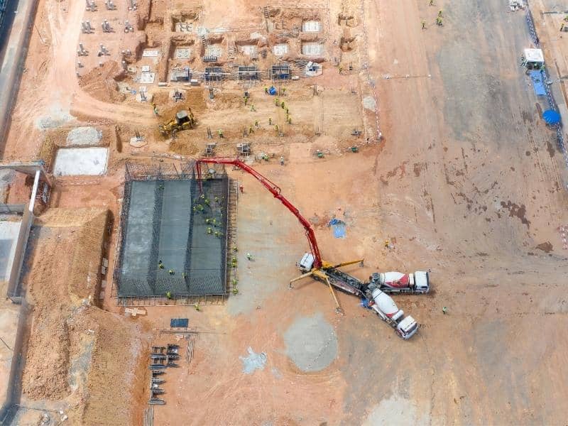
Planning Building Pads on Uneven High-Altitude Land
High-altitude land rarely gives builders a nice flat spot. Every possible pad site sits on some kind of slope or bench. Picking the wrong one adds cost and risk. Drone LiDAR helps teams weigh their options with real numbers instead of guesses.
Point cloud data shows the shape of the ground in fine detail. That helps planners compare pad choices across the site by looking at:
- How much cut and fill each spot would need
- Whether the pad would need a retaining wall
- How close each pad sits to steep drops
- Where natural ground can hold the load with little change
Side-by-side views speed up the pick. Teams end up on stable ground and skip most of the costly fixes that come from poor pad choices.
Evaluating Drainage Flow on Elevated Construction Sites
Water moves fast on mountains. A storm that would soak into flat ground instead races down slopes and picks up soil along the way. Poor drainage plans can wash out roads, cut deep gullies and flood building pads. Site teams have to know where water wants to go before they change the ground.
Drone LiDAR terrain data traces the likely flow paths across the whole site. Planners see where runoff will pool, where slopes may erode and where low points will collect water. That view helps them place culverts, drains and swales in the right spots the first time. The payoff is fewer washouts, less soil loss and roads that hold up when heavy rain hits the mountain.
Reducing Field Crew Exposure in Remote High-Elevation Areas
Walking a mountain site is slow, hard work. Crews often deal with loose rock, thin air, cold wind and long hikes just to reach one measuring spot. Every hour spent on foot in that setting adds risk. A slip on wet rock or a rolled ankle miles from the road can turn into a serious problem.
Drone LiDAR cuts most of that field time. The drone flies over cliff faces and steep zones without asking a person to climb them. Teams get clean data on the parts of the site that would be hardest and riskiest to walk by hand. Field crews still visit key spots, but they no longer have to cover every inch of tough ground on foot.
Fewer field hours also mean fewer weather delays. When a storm rolls in, teams no longer lose a full day of ground work. The drone can fly during calmer windows and keep the survey on track even when the mountain refuses to cooperate.
Frequently Asked Questions
How does Drone LiDAR help with high-elevation construction planning?
The drone captures point cloud data across steep and uneven mountain land in a short flight. Planners use this data to review slopes, access lines, drainage paths and possible building spots before any crew starts work. Early views like this support safer choices and better site layouts.
Why are high-elevation construction sites harder to survey?
Mountain sites often mix steep grades, rock outcrops, loose walking zones and limited access from roads. Weather can shift within an hour and cut short a field day. All of this makes full ground surveys slow, tiring and sometimes unsafe for crews on the site.
Can Drone LiDAR point clouds help choose building pad locations?
Yes. Point cloud data shows the true shape of the ground in fine detail. Teams can compare flatter zones, slope breaks and drainage paths across the whole site. That makes it easier to find pads that need less grading and less wall support during the build.
How does LiDAR support drainage planning on mountain sites?
LiDAR shows how water is likely to flow across steep land based on real ground shape. Planners can see where runoff picks up speed, where it may pool and which slopes could wash out. This helps them place drains and shape grades before any dirt work starts.
Is Drone LiDAR useful for remote construction sites?
Yes. The drone covers rough or unsafe zones far faster than a walking crew can. It also gathers data in spots that would be too risky to reach on foot. Remote mountain projects gain both speed and safety from this kind of survey work.