↓
 

Colorado Springs Land Surveying

Local Land Surveyors in Colorado Springs, CO

Colorado Springs Land Surveying
  • Home
  • ALTA Survey
  • Boundary Surveying
  • Construction Survey
  • Drone LiDAR Mapping
  • Elevation Certificate
  • Land Surveying
  • Topographic Survey
  • Blog
  • Contact Us
Home 1 2 3 … 7 8 >>

Post navigation

← Older posts

Welcome to Colorado Springs Land Surveying

Colorado Springs Land Surveying Posted on August 18, 2017 by ColoradoSpringsSurveyorApril 15, 2020

Your Final Stop for ALL of Your Survey Needs!                                         Contact us today for a free quote!

This site is intended to provide you with information on Land Surveying in the Colorado Springs, CO and El Paso County area of Colorado. If you’re looking for a Colorado Springs Land Surveyor, you’ve come to the right place. If you’d rather talk to someone about your land surveying needs, please call our local number at (719) 722 2536 today. For more information, please continue to read.

land surveyingLand Surveyors are professionals who make precise measurements to determine the size and boundaries of a piece of real estate.  While this is a simplistic definition, boundary surveying is one of the most common types of surveying related to home and land owners. If you fall into the following categories, please click on the appropriate link for more information on that subject:

Colorado Springs Land Surveying services:

    1. I need to know where my property corners or property lines are. (Boundary Survey)
    2. I have a loan closing or re-finance coming up on my home in a subdivision. (Lot Survey)
    3. I need a map of my property with contour lines to show elevation differences for my architect or engineer. (Topo Survey)
    4. I’ve just been told I’m in a flood zone or I’ve been told I need an elevation certificate in order to obtain flood insurance or prove I don’t need it. (Flood Survey)
    5. I’m purchasing a lot/house in a recorded subdivision. (Lot Survey – See Boundary Survey if you’re not in a subdivision.)
    6. I’m purchasing a larger tract of land, acreage, that hasn’t been subdivided in the past. (Boundary Survey)

Contact Colorado Springs Land Surveying services TODAY at (719) 722 2536.

Posted in boundary surveying, elevation certificate, land surveying, land surveyor | Tagged boundary survey, Colorado Springs Land Surveying, land surveyor, land surveyor colorado-springs co

High-Elevation Construction Planning Supported by Drone LiDAR Point Cloud Mapping

Colorado Springs Land Surveying Posted on July 2, 2026 by ColoradoSpringsSurveyorJuly 2, 2026
Aerial view of an active construction site with machinery, foundation work, exposed ground, and open areas used for drone LiDAR terrain planning.

Working at high altitude puts extra pressure on every part of a job. Slopes are steep. Weather turns fast. Crews have less room for error. Drone LiDAR point cloud mapping gives planners a full view of mountain sites before crews even show up. The tool scans the land from the air and builds a 3D model made of millions of points. That model shows every ridge, drop and slope on the site. With this data in hand, teams can plan roads, pads and safety zones on solid facts, not rough guesses.

Mapping Steep Mountain Terrain Before Construction Access Begins

Mountain sites rarely look the same from two spots on the ground. A hill that seems gentle from below may hide sharp drops on the other side. Ridgelines, benches and rocky steps break up the land in ways that maps often miss. Crews need the full shape of the site before they cut in roads or set up staging areas.

Drone LiDAR captures all of this in one flight. The point cloud shows steep grades, flat benches, tight turns and open zones. Planners can pick smart lines for haul roads that skip the worst drops. They can find the flatter shelves that work well for parking gear or setting up field offices.

The point cloud also gives every part of the team a shared reference. The site engineer, the road crew and the safety lead all work from the same 3D model. That cuts down on confusion when routes shift or plans change during the build.

Identifying Rock Faces and Drop-Off Zones in Point Cloud Data

Cliffs and rock shelves are hard to see from ground level. A cliff edge might blend into thick brush. A sharp break in grade might look like a gentle slope from far away. These hidden risks can trap workers and damage gear if teams walk into them by surprise.

Point cloud data makes these features stand out. Rock faces show up as sheer walls in the model. Drop-off zones appear as sudden shifts in surface height. Planners can flag these spots on a site map before any crew heads out. Early risk review keeps workers away from cliffs and helps designers set safe buffer zones. It also gives survey teams a way to plan routes around the worst parts of the land.

Planning Building Pads on Uneven High-Altitude Land

High-altitude land rarely gives builders a nice flat spot. Every possible pad site sits on some kind of slope or bench. Picking the wrong one adds cost and risk. Drone LiDAR helps teams weigh their options with real numbers instead of guesses.

Point cloud data shows the shape of the ground in fine detail. That helps planners compare pad choices across the site by looking at:

  • How much cut and fill each spot would need
  • Whether the pad would need a retaining wall
  • How close each pad sits to steep drops
  • Where natural ground can hold the load with little change

Side-by-side views speed up the pick. Teams end up on stable ground and skip most of the costly fixes that come from poor pad choices.

Evaluating Drainage Flow on Elevated Construction Sites

Water moves fast on mountains. A storm that would soak into flat ground instead races down slopes and picks up soil along the way. Poor drainage plans can wash out roads, cut deep gullies and flood building pads. Site teams have to know where water wants to go before they change the ground.

Drone LiDAR terrain data traces the likely flow paths across the whole site. Planners see where runoff will pool, where slopes may erode and where low points will collect water. That view helps them place culverts, drains and swales in the right spots the first time. The payoff is fewer washouts, less soil loss and roads that hold up when heavy rain hits the mountain.

Reducing Field Crew Exposure in Remote High-Elevation Areas

Walking a mountain site is slow, hard work. Crews often deal with loose rock, thin air, cold wind and long hikes just to reach one measuring spot. Every hour spent on foot in that setting adds risk. A slip on wet rock or a rolled ankle miles from the road can turn into a serious problem.

Drone LiDAR cuts most of that field time. The drone flies over cliff faces and steep zones without asking a person to climb them. Teams get clean data on the parts of the site that would be hardest and riskiest to walk by hand. Field crews still visit key spots, but they no longer have to cover every inch of tough ground on foot.

Fewer field hours also mean fewer weather delays. When a storm rolls in, teams no longer lose a full day of ground work. The drone can fly during calmer windows and keep the survey on track even when the mountain refuses to cooperate.

Frequently Asked Questions

How does Drone LiDAR help with high-elevation construction planning?

The drone captures point cloud data across steep and uneven mountain land in a short flight. Planners use this data to review slopes, access lines, drainage paths and possible building spots before any crew starts work. Early views like this support safer choices and better site layouts.

Why are high-elevation construction sites harder to survey?

Mountain sites often mix steep grades, rock outcrops, loose walking zones and limited access from roads. Weather can shift within an hour and cut short a field day. All of this makes full ground surveys slow, tiring and sometimes unsafe for crews on the site.

Can Drone LiDAR point clouds help choose building pad locations?

Yes. Point cloud data shows the true shape of the ground in fine detail. Teams can compare flatter zones, slope breaks and drainage paths across the whole site. That makes it easier to find pads that need less grading and less wall support during the build.

How does LiDAR support drainage planning on mountain sites?

LiDAR shows how water is likely to flow across steep land based on real ground shape. Planners can see where runoff picks up speed, where it may pool and which slopes could wash out. This helps them place drains and shape grades before any dirt work starts.

Is Drone LiDAR useful for remote construction sites?

Yes. The drone covers rough or unsafe zones far faster than a walking crew can. It also gathers data in spots that would be too risky to reach on foot. Remote mountain projects gain both speed and safety from this kind of survey work.

Posted in LiDAR Mapping | Tagged Drone LiDAR

What Longtime Colorado Springs Property Owners Often Discover Before Expanding Their Land Use

Colorado Springs Land Surveying Posted on June 25, 2026 by ColoradoSpringsSurveyorJune 21, 2026
Longtime Colorado property owners discussing future uses for open acreage near barns and pastureland.

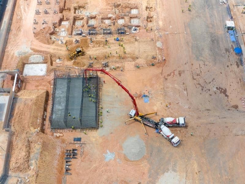
Many longtime property owners in Colorado Springs hold onto land for decades before they think about changing how they use it. A few acres bought for one purpose can end up serving several purposes over the years. When an owner decides to expand or change how the land gets used, land surveying often becomes the first step. It shows what the property looks like now, not what an old deed or a faded memory suggests. That starting point matters more than most owners expect.

Why Large Properties Tend to Accumulate More Uses Over the Years

A large property rarely stays the same for thirty years. An owner might start with a single house and a barn, then add a garden, then a workshop, then a spot for parking an RV. Each change feels small at the time. Added together, they reshape how the entire property functions.

Agricultural uses often shift first. A pasture that once held cattle might sit empty for a season, then turn into a hay field. Later, it might become space for a few horses kept just for enjoyment. Recreational areas tend to follow the same pattern. A flat corner of land that worked for a garden in one decade might later become a spot for a fire pit or a small orchard.

None of these changes usually get planned in advance. They happen because an owner’s needs shift, and the land has room for it. Over enough years, a property ends up serving five or six purposes that were never written down anywhere, just added bit by bit.

Expanding Land Use Starts With Understanding How Much Usable Space Exists

Owning ten acres and knowing what to do with ten acres are two very different things. A property can look spacious on paper while actually offering much less usable ground than the acreage suggests. Slopes, wet areas, and tree cover can all eat into the space an owner assumes is available.

Access points matter just as much as open space. A back section of land might look perfect for a new building. But if there’s no practical way to reach it with equipment or vehicles, that section stays limited no matter how much room it has. Existing site conditions, like old fence lines or drainage paths, can affect what actually works too.

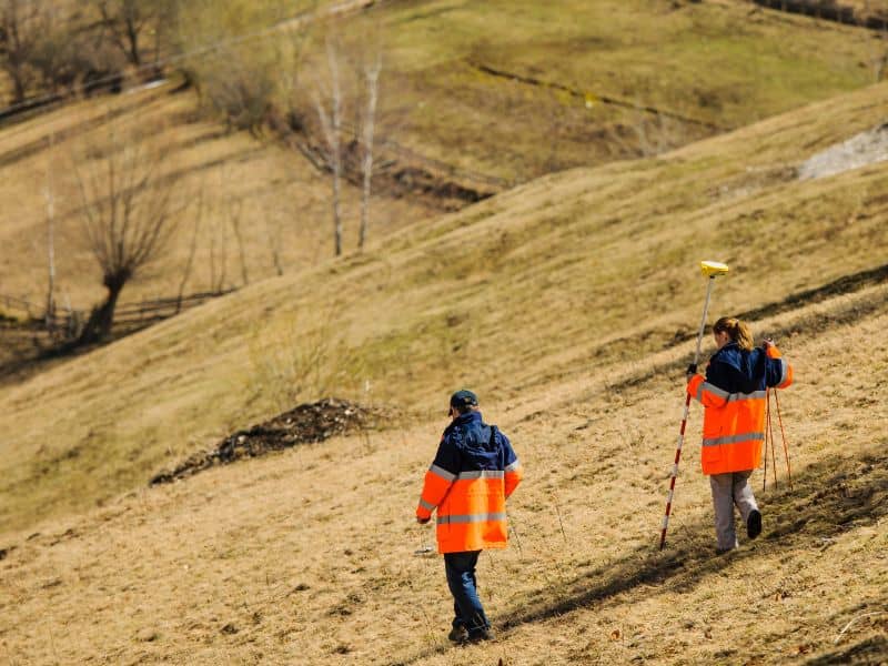
Land surveying gives an owner real numbers instead of rough guesses. It marks out exactly where the usable ground sits and where the limits are. It also shows how the land’s features line up with the owner’s plans. That clarity changes the conversation from what looks possible to what’s actually possible.

Different Generations Often Leave Different Priorities Behind

Land that stays in a family for a long time usually passes through more than one set of priorities. A grandparent might have focused on livestock and crops. A parent might shift toward recreation, clearing space for trails or a pond. A grandchild might want to add a guest house or expand the property for a home business.

Each generation tends to leave behind decisions that made sense at the time but don’t always match current goals. An old fence built for cattle might now sit in the way of a planned driveway. A cleared field meant for crops might be exactly where a new owner wants to build.

Land surveying helps sort through all of this. It shows the property as it stands today, separate from whatever plans or assumptions earlier generations had in mind. That clear picture lets the current owner make their own decisions instead of working around outdated ideas.

Property Expansion Is Often Triggered by Lifestyle Changes Rather Than Construction Plans

Most owners don’t wake up one day and decide to build something new just because they can. Expansion usually starts with a change in life, not a change in blueprints. A few common triggers show up again and again on long-held properties.

  • Retirement, which frees up time for a hobby that needs more space
  • A growing family that needs more room to spread out
  • A home business that outgrows a spare bedroom
  • A new interest, like raising animals or running a workshop

None of these reasons start with construction. They start with a shift in how someone wants to live. Once that shift happens, the construction questions follow. But the real decision is about lifestyle first.

That order explains why expansion plans on long-held land often look so different from what a first-time buyer might plan on a brand-new lot. The land was already there. The life around it changed.

Land Surveying Creates a Clear Starting Point for the Next Phase of Ownership

Whatever direction an owner takes, land surveying gives them a reliable place to start. It documents the property’s current shape, its usable space, and its physical conditions without relying on memory or old paperwork. That kind of clarity supports better planning, whether the next step is small or significant.

Long-term stewardship depends on accurate information. An owner who understands their land’s real conditions can plan additions, transitions, or new uses with far more confidence than one working from assumptions. This matters even more on properties that have changed hands or changed purposes multiple times over the years.

Land surveying doesn’t decide what an owner should do with their property. It simply confirms what’s actually there. For longtime owners starting a new chapter, that starting point makes every decision after it a little easier.

Frequently Asked Questions

Why do longtime property owners eventually reconsider how they use their land? 

Changing family needs, new hobbies, and shifting future goals often lead owners to look at their property differently after many years. What worked for one stage of life doesn’t always fit the next. Land surveying can help confirm what’s actually possible once those new goals take shape.

Can land surveying support future land use decisions?

Yes. Land surveying provides accurate information about a property’s layout, boundaries, and physical features before changes get planned. That information helps owners avoid guesswork when deciding how to use their land going forward. It also gives builders and family members a shared, accurate picture to work from.

Why do large properties evolve over time?

Different owners and different stages of life tend to bring new priorities to the same land. A use that made sense decades ago often gets replaced gradually by something else entirely. This shift happens naturally on properties that stay in one family’s hands for a long time.

Is land surveying only useful before buying property?

No. Many longtime owners rely on land surveying years or even decades after a purchase, especially when they’re evaluating new opportunities. A survey can confirm current conditions long after the original purchase survey, if one even exists. This makes it useful at almost any stage of ownership, not just the beginning.

When should property owners consider updating survey information?

Owners often seek updated survey information when planning a new phase of ownership or changing how the property gets used. It also helps to update this information before adding new structures that depend on accurate boundaries. Preparing early tends to prevent costly surprises once changes begin.

Posted in land surveying | Tagged Land Surveying

Why Hillside Lots in Colorado Springs Make Topographic Surveys More Important Than Owners Realize

Colorado Springs Land Surveying Posted on June 19, 2026 by ColoradoSpringsSurveyorJune 21, 2026
Surveyors collecting elevation data on a steep hillside property in Colorado Springs to support topographic survey planning.

Colorado Springs sits where the plains meet the Rockies. That gives hillside buyers something flat-lot owners never get, a view that stretches for miles. The same slope that creates the view also creates conditions a flat lot never has to deal with. A topographic survey maps those conditions before a shovel touches the ground. It shows how the land rises, falls, and drains across the property. Owners who skip this step often learn the hard way that a beautiful lot and a buildable lot aren’t always the same thing.

Why Colorado Springs Terrain Creates Different Challenges From Flat Lots

A flat lot rarely surprises a builder. The ground sits at one elevation, and water moves in predictable directions. Hillside parcels in Colorado Springs work differently, since the ground itself can shift in shape from one corner of the lot to the other.

Foothill terrain along the Front Range can change twenty or thirty feet in elevation across a single lot. That affects where a house can sit, how a garage connects to the street, and how much yard space stays usable once grading limits apply. A topographic survey turns those unknowns into real numbers. It maps the land so an owner can see its true shape instead of guessing from a walk-through. This matters most before design begins, not after, because changing course once a floor plan is set gets expensive fast.

Water Always Follows the Slope, Whether Owners Plan for It or Not

Water doesn’t care about property lines or building plans. It just moves downhill. Summer storms in Colorado Springs can drop heavy rain fast. On a sloped lot, the direction water travels can decide whether a foundation stays dry or a basement floods.

A topographic survey shows exactly where the high points and low points sit on a property. That tells an owner how runoff will behave once construction disturbs the ground. Without it, a homeowner installing a driveway or a patio is really just guessing which way water will run after the slope gets reshaped. Put a retaining wall in the wrong spot, and water that used to spread out across open ground can push against a foundation wall instead. Builders use this elevation data to plan drains and grading that move water away from structures. Skipping that step doesn’t make the water disappear. It just lets the slope decide where the water goes.

Views and Building Sites Rarely Compete for the Same Space

Most buyers choose a hillside lot in Colorado Springs for one reason, the view. A ridge line or a clear sightline toward Pikes Peak can sell a property before a buyer even checks the soil. The trouble is that the best view and the easiest place to build are often two different spots on the same lot.

A steep ridge edge might offer the most dramatic scenery. That same edge can come with grading limits or drainage paths that make construction there difficult. A topographic survey separates the buildable area from the scenic high points, so a designer can see where the two overlap and where they don’t. This often changes how a house gets placed, sometimes pulling it back from the slope’s edge to protect both the view and the structure. A deck or a window wall can often capture most of a view without putting the foundation itself in a risky spot.

Elevation Changes Influence More Than the House Itself

A house footprint is only part of what a slope affects. Driveways on hillside lots need a workable grade for everyday use. Colorado Springs winters make that even more important, since ice and snow can turn a steep driveway into a daily hazard. Walkways, patios, and outdoor living spaces all answer to the same elevation changes that shape the home’s foundation.

A topographic survey gives designers the numbers they need to plan around several things tied directly to the slope.

  • Driveway grade and turning room near the street
  • Patio and deck placement relative to the slope
  • Access paths to the lower or upper portions of the lot
  • Retaining wall height and placement where grade changes sharply

Landscaping runs into the same questions. A planting bed that looks fine on flat ground can wash out completely on a slope without the right grading underneath it. Even reaching the back corner of a hillside lot on foot can become a design problem if the survey isn’t part of the planning from the start.

Topographic Surveys Help Designers Work With the Land Instead of Against It

Architects and engineers who work on hillside lots in Colorado Springs rely on topographic data the same way a tailor relies on measurements. The plan only fits well when the numbers are accurate. Contour lines and slope percentages give a designer the real shape of the property before a single line gets drawn on a floor plan.

Working with the land usually means less grading, not more. A house that follows the natural contour of a slope often needs less excavation than one that fights against it. That difference shows up directly in cost. Builders who start with accurate topographic data can plan foundations, walls, and drainage as one connected system. They don’t have to solve each problem on its own mid-build. The lots that turn out best on Colorado Springs hillsides are usually the ones where the design worked with the terrain, not against it.

Frequently Asked Questions

Why are topographic surveys especially useful for hillside properties?

Hillside properties have elevation changes that flat lots don’t. Those changes affect drainage, access, and where a home can sit. A topographic survey records the exact shape of the land, so builders work from real information instead of a guess.

Can a topographic survey help with retaining wall planning?

Yes. Elevation data shows where the grade changes sharply enough to need a wall instead of a simple slope. Engineers use that information to decide how tall a wall needs to be and where it should go. Getting this right early helps avoid costly redesigns later.

Why do sloping lots require more planning than flat properties?

Flat lots rarely raise questions about drainage or usable space, since the ground stays consistent. Sloped lots bring up all three at once, because water runs differently and not every part of the lot is easy to build on. That means a sloped lot needs more groundwork before design decisions get locked in.

Do topographic surveys show how water moves across a property?

Yes. A topographic survey records elevation points across the lot, and those points reveal which direction water will travel during a storm. Designers use that data to plan drainage and grading that keep water away from foundations and outdoor spaces.

Who typically uses the information from a topographic survey?

Architects, engineers, and builders rely on topographic surveys to design homes that fit the property’s real terrain. Landscape designers use the same data to plan grading and outdoor spaces that hold up over time. Owners benefit too, since the survey shows what their lot can realistically support before construction begins.

Posted in topographic survey | Tagged Topographic Survey

Post navigation

← Older posts
Get Quote Button
© Colorado Springs Land Surveying
Colorado Springs, Colorado
Phone: (719) 722 2536

Web Development and SEO by:
AuburnBusiness.Com, LLC


Privacy Policy | Terms of Use

The owner of this website, Boxer Survey USA, provides coordination of professional land surveying and engineering services in all 50 states. The professional surveying and engineering services provided to you will be conducted by fully licensed professionals in your state.

↑